HDR Receives Esri’s Integration Award for ArcGIS Work on North Carolina Pipeline Project
HDR has received special recognition from Esri for streamlining data sharing on a natural gas pipeline project.
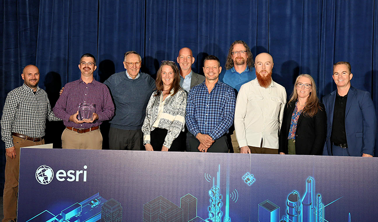
The world leader in location intelligence and geographic information system technology, Esri granted the Integration award to HDR for its leveraging ArcGIS for AutoCAD software on Dominion Energy North Carolina’s Kannapolis to Concord Pipeline Expansion Project. The award was recently presented at the 2024 Esri Infrastructure Management and GIS Conference in Palm Springs, California.
HDR was one of 11 partner organizations selected for an award by demonstrating innovative and creative ways to solve complex problems using the ArcGIS software and helping advance GIS technology. Esri has a global network of over 2,800 partners, including HDR.

HDR’s project team used ArcGIS software as a unique, one-stop-shop software solution to bring data from several different disciplines on a 24-mile pipeline construction project into an easy-to-manage program, improving coordination, accuracy and communication among team members, subcontractors and the client.
The program stores and displays necessary project details – like land acquisition status, surveying information, pipeline route, construction progress and more – on a digital map and can be synced with one click, saving time and making it easy to view real-time information. Pipeline construction is currently underway. Once complete, the project will help improve natural gas access and reliability for growing areas northeast of Charlotte, North Carolina.
Chris Abbott, senior GIS analyst; Andrew Zimba, GIS manager; and Jacob Matuseski, CADD lead; led the joint effort for HDR to deploy ArcGIS on the project. Abbott was one of several HDR team members who accepted the award at the Esri conference.
“Alongside many other GIS and design experts at HDR, we worked hard to bring this solution together, and we’re excited to bring it to more projects in the future,” Abbott said. “This award highlights our ability to work together across all the disciplines to find unique technical solutions for our clients.”
Esri featured HDR’s project as a case study on their website, detailing the process of integrating ArcGIS and complex problems the software helped solve.
“Esri congratulates HDR on their 2024 IMGIS award in recognition of their innovative work leveraging ArcGIS software,” said Thomas Fair, director of Esri Partner Network. “We are proud to partner with HDR to foster the use of GIS technology in support of our mutual customers improving infrastructure.”
Learn more about HDR’s geospatial and information management services.
About Esri
Esri, the global market leader in geographic information system (GIS) software, location intelligence, and mapping, helps customers unlock the full potential of data to improve operational and business results. Founded in 1969 in Redlands, California, USA, Esri software is deployed in hundreds of thousands of organizations globally, including Fortune 500 companies, government agencies, nonprofit institutions, and universities. Esri has regional offices, international distributors, and partners providing local support in over 100 countries on six continents. With its pioneering commitment to geospatial technology and analytics, Esri engineers the most innovative solutions that leverage a geographic approach to solving some of the world’s most complex problems by placing them in the crucial context of location. Visit us at esri.com.
About HDR
HDR is a 100% employee-owned professional services firm. Founded over a century ago to bring electricity to a changing world, we are now a global company specializing in engineering, architecture, environmental and construction services. Our success in built and natural environments continues as we collaborate to solve our clients’ and communities’ most complex challenges.


